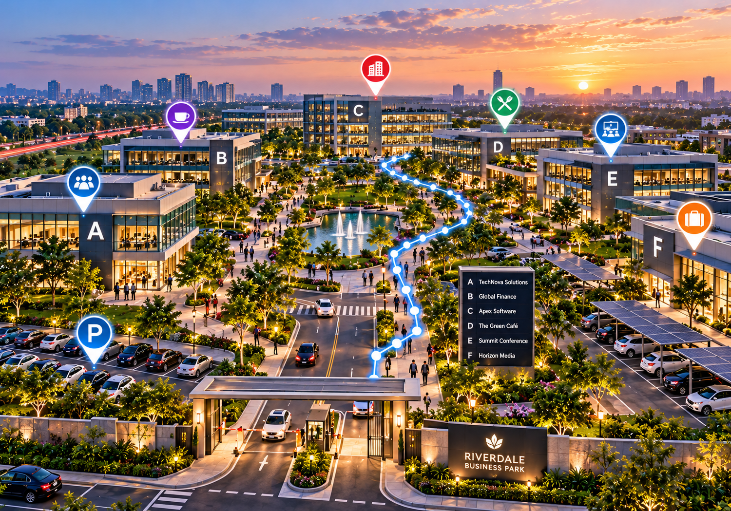
Interactive Maps for Business Parks: Help Visitors Find Companies
Discover how interactive business park maps help visitors locate companies, office buildings, entrances, parking areas, and essential facilities with greater ease.
Arriving at a modern business park or commercial office complex should mark the beginning of a productive meeting or successful delivery. However, for many visitors, entering a large commercial property brings unexpected spatial confusion. Finding a specific company across sprawling office parks featuring multiple buildings, shared parking structures, separate entrances, and confusing suite numbering systems frequently leads to frustration, lost time, and delayed appointments.
Visitors, job applicants, business partners, clients, service contractors, and delivery personnel routinely arrive on-site with only a company name and a general address. Without clear directional guidance, identifying which building houses the target business—and which entrance leads to their reception desk—can turn a routine visit into an unnecessary hassle.
Implementing interactive maps for business parks offers a practical, modern approach to commercial property navigation. By digitizing property layouts and combining interactive building graphics with searchable tenant directories, property managers can make company locations easy to discover, streamline visitor arrival, and deliver a polished corporate image.
What Is an Interactive Map for a Business Park?
An interactive business park map is a digital, mobile-responsive visual representation of a commercial property that displays building layouts, tenant listings, office suites, entrances, parking areas, and shared facilities in an organized visual format.
Unlike static metal directory boards or paper site plans, digital business park maps enable users to view the entire property overview, zoom into specific office buildings, search for tenants by company name, and tap points of interest (POIs) to review location details, such as suite numbers, entrance locations, or visitor parking guidelines.
A Real-World Example
Consider a client arriving at a 12-building technology park for a 10:00 AM meeting at "Apex Software Solutions." Instead of wandering past multiple buildings or asking security guards for directions, the visitor opens the business park's digital map on their smartphone or scans a QR code at the entrance gate. They search for "Apex Software Solutions," view the exact building (Building C), see the designated visitor parking area right beside it, and identify the primary ground-floor entrance leading directly to reception. The visitor arrives on time and stress-free.
Why Business Parks Need Better Visitor Navigation
Managing visitor flow in multi-tenant commercial properties presents unique operational and communication challenges:
-
Multiple Buildings & Shared Addresses: Business parks often share a single street address across several numerical or alphabetical building blocks, confusing first-time visitors.
-
Frequent Tenant Turnover: Commercial properties regularly welcome new businesses or accommodate internal suite expansions, making physical directory boards expensive and difficult to maintain.
-
Complex Entry Points: Large office buildings frequently feature separate entrances for primary reception, freight delivery, employee keycard access, and visitor registration.
-
Unclear Parking Restrictions: Visitors often struggle to distinguish between reserved employee parking, visitor zones, delivery bays, and accessible spaces.
-
High Volume of Daily Couriers & Contractors: Delivery drivers handling time-sensitive packages require immediate spatial clarity to locate specific loading docks and suite numbers quickly.
-
Pressure on Property Management & Security: Front-desk security guards and property management staff spend excessive time answering routine directional questions rather than focusing on property security and operations.
Providing clear, accessible visual location data helps eliminate spatial uncertainty, ensuring a smoother visit for guests and a more efficient workplace for tenants.
Key Benefits of Interactive Maps for Business Parks
Adopting digital wayfinding for business parks delivers tangible operational and experiential advantages across the commercial property ecosystem:
1. Help Visitors Find Companies Faster
Organized company listings linked directly to mapped building markers allow visitors to locate target businesses instantly without guessing which building to enter.
2. Make Multi-Building Complexes Easier to Understand
A clear visual layout gives visitors an immediate spatial overview of the property, helping them understand how different office blocks, pedestrian walkways, and driving lanes connect.
3. Improve Access to Entrances and Reception Areas
Highlighting primary visitor entrances, main lobby reception desks, and security check-in counters ensures guests arrive at the correct point of contact on their first attempt.
4. Make Parking and Shared Facilities Easier to Locate
Mapping designated visitor parking zones, EV charging stations, accessible parking bays, public restrooms, on-site cafés, conference centers, and outdoor break areas enhances overall site convenience.
5. Improve the Visitor Experience
Delivering clear spatial guidance reduces anxiety for clients, interview candidates, and international partners, projecting a tech-forward, professional image for the entire business park.
6. Support Business Discovery
Connected tenant directories allow visitors, employees, and nearby workers to discover other businesses operating within the park, such as on-site legal services, printing shops, or dining options.
7. Simplify Location Information for Property Managers
Digital mapping systems provide a centralized format for property managers to maintain accurate tenant listings and facility updates without incurring recurring physical signage costs.
What Information Should a Business Park Map Include?
Property administrators should curate a comprehensive checklist of location markers and details to include on their interactive digital map:
-
Business Park Name & Master Layout: Clear visual graphics representing the full property boundaries and main access roads.
-
Building Names, Numbers & Blocks: Clearly labeled structures matching physical building signage.
-
Tenant Directory & Office Suite Numbers: Searchable company names mapped to their specific floor levels and suite locations.
-
Main Entrances & Lobby Registrations: Clearly identified visitor entry doors and security check-in counters.
-
Visitor & Employee Parking Zones: Distinct visual markers for visitor parking decks, reserved spaces, and EV charging stations.
-
Accessible Entrances & Parking: Verified step-free access routes, ramps, elevators, and designated accessible parking bays.
-
On-Site Dining & Shared Amenities: Cafés, restaurants, food truck zones, outdoor seating, and fitness centers.
-
Meeting & Conference Facilities: Shared auditorium spaces, bookable boardrooms, and event spaces.
-
Public Transport Links & Transit Hubs: Bus stops, shuttle pick-up points, bicycle racks, and nearby metro stations.
-
Property Management & Leasing Offices: Locations for site management counters and leasing inquiry offices.
-
Emergency Assembly Points: Verified safety zones and emergency exits approved by facility management.
Interactive Maps vs. Traditional Business Park Directories
While static metal directory boards and entrance monument signs provide basic physical landmarks, digital interactive maps offer significant functional advantages.
| Feature | Traditional Directory Board | Interactive Digital Map |
| Finding Company Names | Restricted to listed physical text; manual visual scanning | Searchable tenant directory by keyword, building, or category |
| Understanding Property Layout | Fixed 2D overview panel located only at park entrances | Interactive visual map viewable anywhere via mobile devices |
| Accessing Location Details | Limited to concise text labels and building numbers | Rich pop-up profiles with suite numbers, web links, and descriptions |
| Updating Company Information | Physical sign changes require reprinting, costs, and delays | Digital directory updates can be published instantly online |
| Exploring Multiple Buildings | Static graphic view that cannot show multi-floor details | Toggle between building levels, wings, and outdoor zones |
| Sharing Location Data | Impossible to share digitally prior to guest arrival | Shareable via website links, URLs, and QR code access points |
| Visitor Convenience | Requires stopping at physical entrance boards | Pre-visit planning on desktop or on-the-go viewing on mobile |
How to Create an Interactive Map for a Business Park
Building an interactive map for a commercial property follows a practical, structured implementation process:
Step 1: Collect Accurate Property Information
Audit the business park layout to compile an updated list of building names, tenant suite assignments, visitor entrances, parking areas, and shared amenities.
Step 2: Prepare the Business Park Layout
Obtain a clean site vector diagram, CAD file, or high-resolution architectural layout representing the property’s building footprints, roadways, and pedestrian paths.
Step 3: Organize Company Locations
Structure company data into a logical tenant directory, mapping each business to its respective building number, floor, and suite assignment.
Step 4: Add Useful Location Details
Incorporate relevant company labels, category tags (e.g., Technology, Legal, Finance, Dining), operating hours, and entrance pointers based on platform capabilities.
Step 5: Test the Map
Test the map across desktop screens and mobile devices to verify label clarity, search responsiveness, and accurate marker placement.
Step 6: Publish and Share the Map
Deploy the map by embedding it on the property management website, adding links to tenant welcome portals, and displaying QR codes across physical entrance signage.
Step 7: Keep Information Updated
Establish an operational schedule to update tenant listings immediately whenever businesses move in, relocate suites, or update their corporate branding.
How eMap.live Can Fit Into a Business Park Mapping Workflow
For commercial property developers, facility managers, and business park administrators evaluating digital mapping options, eMap.live provides a flexible web-based platform to build, customize, and share interactive property maps.
By visiting https://emap.live/, property managers can explore how the platform supports commercial real estate and business park mapping use cases. Confirmed features relevant to business parks include:
-
Custom Vector Map Creation: Transform static architectural site plans into clean, web-first interactive maps featuring clickable building markers and points of interest.
-
Mobile Browser Responsiveness: Maps load directly inside standard mobile web browsers on iOS and Android devices without requiring visitors to download an application.
-
Searchable Directories & Categories: Group business park tenants into custom searchable categories (e.g., Buildings, Financial Services, Dining, Parking), making it simple for visitors to find specific companies.
-
QR Code & Web Link Distribution: Easily generate shareable web links and QR codes to place on physical entrance signs, visitor badges, or property management websites.
-
Simple Dashboard Management: Update tenant listings, edit building labels, or adjust facility details through a user-friendly management dashboard without coding knowledge.
Before selecting a solution, property administrators should review eMap.live's website to verify current feature sets, supported file formats, and customization options against their specific site requirements.
Best Practices for Designing a Useful Business Park Map
To ensure a digital business park map delivers maximum utility to visitors, keep these practical recommendations in mind:
-
Prioritize Simplicity & Accuracy: A clean, uncluttered layout with accurate building numbers is far more effective than a busy map overcrowded with unnecessary visual graphics.
-
Maintain Consistent Nomenclature: Ensure building labels, gate numbers, and suite identifiers on the digital map match physical concourse signage exactly.
-
Design Mobile-First: Use touch-friendly category buttons, readable font sizes, and high-contrast colors suitable for viewing on smartphones outdoors in daylight.
-
Highlight High-Traffic Amenities: Clearly distinguish visitor parking, management offices, central cafeterias, and primary entrance gates.
-
Verify Accessibility Data: Only display step-free pathways, ramp locations, and accessible parking bays after on-site physical verification.
-
Establish Clear Update Responsibilities: Assign a dedicated property management staff member to publish tenant updates as leasing changes occur.
Common Mistakes to Avoid
When creating and publishing an interactive business park map, avoid these common operational pitfalls:
-
Publishing Outdated Tenant Data: Leaving old company names on the map confuses visitors and reflects poorly on property management.
-
Omitting Visitor Entrances: Marking a building footprint without showing where visitors should actually enter creates confusion.
-
Neglecting Mobile Usability: Failing to test map loading speeds and touch controls on mobile devices creates friction for on-site visitors.
-
Overcomplicating Categories: Creating dozens of confusing sub-categories makes finding a simple company name difficult.
-
Over-Promising Navigation Features: Claiming a map provides turn-by-turn "blue-dot" indoor navigation when it only offers static visual path guidance misleads users.
Who Can Benefit From Interactive Business Park Maps?
Digital mapping solutions provide value across a broad spectrum of commercial real estate environments:
-
Large Multi-Building Business Parks: Sprawling suburban corporate parks with dozens of separate office blocks.
-
Multi-Tenant Commercial Towers: Urban high-rises housing dozens of independent firms across multiple floors.
-
Technology & Science Parks: Specialized innovation hubs featuring shared research facilities, incubators, and corporate suites.
-
Industrial & Logistics Estates: Commercial estates with complex warehouse bays, administrative suites, and freight loading docks.
-
Mixed-Use Developments: Urban complexes combining corporate offices, retail storefronts, dining venues, and public parking.
Frequently Asked Questions
1. What is an interactive map for a business park?
An interactive map for a business park is a digital, mobile-responsive visual guide that displays building layouts, tenant directories, parking areas, and shared amenities. Accessible via web browsers, it helps visitors explore commercial properties and locate companies easily.
2. How do interactive maps help visitors find companies?
Interactive maps allow visitors to search for businesses by company name, building number, or industry category. The map highlights the specific building, displays floor or suite details, and indicates nearby visitor parking and entrances.
3. What information should a business park map include?
A business park map should include building labels, tenant company names, suite numbers, main visitor entrances, reception desks, visitor parking zones, accessible facilities, dining amenities, transit hubs, and property management offices.
4. Can an interactive map show multiple office buildings?
Yes. Digital mapping platforms can represent multi-building complexes, allowing users to view the entire master layout and select individual building blocks for closer inspection.
5. Can a business park map include company directories?
Yes. Most interactive mapping platforms feature searchable directory lists where companies can be indexed by name, building, or category, connecting search queries directly to visual map pins.
6. Can visitors access an interactive business park map on their phones?
Yes. Modern interactive maps built on web-first platforms like eMap.live load directly inside standard mobile web browsers across iOS and Android without requiring app store downloads.
7. Can QR codes be used to share business park maps?
Yes. Property managers can generate QR codes linked directly to their online map URL. Placing these QR codes on entrance monument signs, lobby posters, or visitor badges allows guests to open the map instantly on their phones.
8. How often should a business park map be updated?
A business park map should be updated whenever a new tenant moves in, an existing business changes suites or leaves the property, or when physical access points and parking rules change.
9. What should property managers consider when choosing business park mapping software?
Property managers should evaluate software based on mobile responsiveness, ease of content updates, custom branding options, directory search capability, QR code support, platform reliability, and pricing flexibility.
10. How can eMap.live help with interactive mapping?
eMap.live allows commercial property managers to convert site floor plans into searchable, mobile-friendly interactive digital maps featuring custom tenant categories, clickable building markers, and QR code sharing options.
Conclusion: Make Business Locations Easier to Find
Providing clear, accessible spatial guidance is a critical component of modern commercial property management. As business parks expand and tenants expect digital-first amenities, traditional metal directory boards alone are no longer sufficient to guide clients, partners, and delivery drivers effectively.
Interactive maps for business parks bridge the gap between physical architecture and digital convenience. By organizing building layouts, publishing searchable tenant directories, and providing mobile web access via QR codes, property managers can eliminate visitor confusion and elevate the professional profile of their commercial real estate asset.
Ready to make your commercial property easier to navigate? Explore eMap.live to evaluate how its web-based interactive mapping platform can support your business park's visitor navigation strategy.
