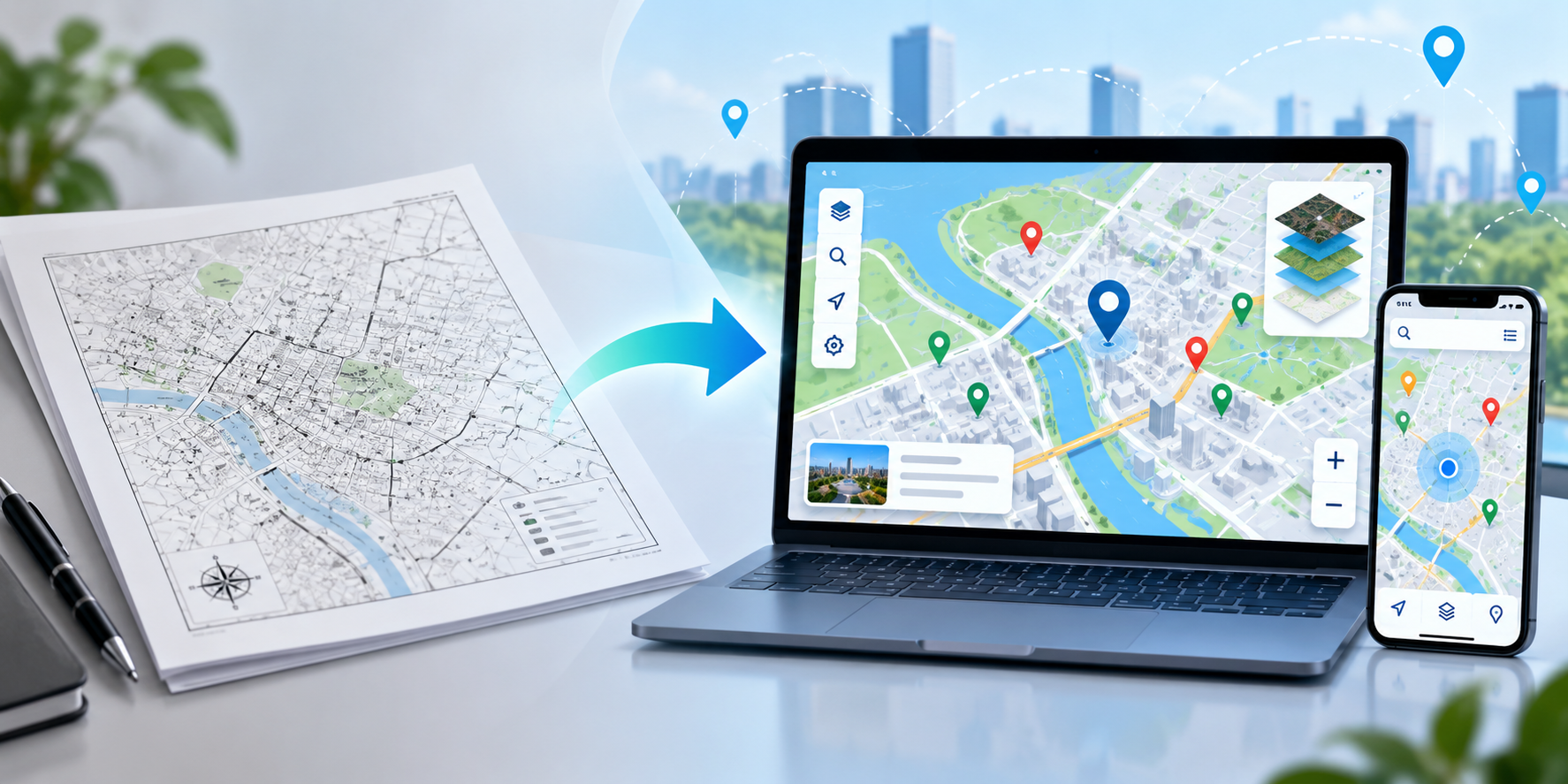
How to Turn a Static Map into an Interactive Digital Map
Learn how to transform static maps into interactive digital maps with better navigation, engaging features, and seamless user experiences.
Introduction
Navigating physical spaces—whether attending a conference, visiting a university campus, exploring a shopping mall, or touring a real estate development—relies heavily on clear maps. For decades, organisations depended on static maps such as printed booklets, physical signage, and digital PDF files. While static maps serve as useful starting points, they often fall short in modern digital environments. Users expect instant searchability, zoom capability, and responsive layout adjustments on smartphones.
Interactive digital maps solve these challenges by transforming rigid graphics into dynamic, engaging navigation tools. By adding elements like searchable location directories, clickable markers, rich media integration, and multi-layer navigation, organisations can deliver seamless navigational experiences.
Moving to interactive mapping improves spatial awareness, reduces visitor confusion, and unlocks useful engagement metrics for managers. This guide walks step-by-step through the process to turn a static map into an interactive digital map, covering key features, practical benefits, common pitfalls, and mapping best practices.
What Is a Static Map?
A static map is a fixed visual representation of a geographic area or facility floor plan. Once generated or printed, its visual information, text labels, scale, and layout remain entirely permanent unless a completely new file or graphic is created.
Common Examples of Static Maps
-
PDF Maps: Downloadable spatial graphics hosted on websites or sent via email.
-
Printed Graphics: Physical brochures, paper handouts, folded pocket maps, and posters.
-
Image-Based Maps: Standalone graphic files in JPEG, PNG, or SVG formats embedded into basic web pages.
-
Physical Signage: Wall-mounted directory boards and outdoor wayfinding displays.
Advantages of Static Maps
-
Low Initial Creation Cost: Simple static graphics can be quickly exported from basic graphic design software.
-
Offline Access: Physical paper prints require no battery power, internet access, or mobile data.
-
Simple Production: Easy to attach to emails or hand out physically at information kiosks.
Limitations of Static Maps
-
No Search Capability: Users must manually scan text labels to locate specific points of interest.
-
Poor Mobile Usability: Static PDFs or images require constant manual pinching, scrolling, and panning on small smartphone screens.
-
Immediate Obsolescence: Minor changes—such as booth reassignments, room renumbering, or vendor updates—require a full reprint or file re-upload.
-
Zero Tracking Metrics: Managers cannot measure how users interact with the map, which areas draw the most attention, or where visitors search most frequently.
What Is an Interactive Digital Map?
An interactive digital map is a web-based or app-driven mapping interface that allows users to actively engage with spatial data. Unlike fixed images, interactive maps dynamically display location content, allowing real-time navigation and feature discovery across devices.
How Users Interact with Digital Maps
-
Fluid Zooming and Panning: Smoothly inspect macro layout overviews down to specific room details without quality loss.
-
Clickable Locations & Markers: Tap on pins, rooms, or landmarks to reveal detailed pop-up cards containing descriptions, photos, business hours, links, or contact details.
-
Keyword Search & Filtering: Instantly search for specific destinations, amenities, or departments via simple text search.
-
Multi-Layer Views: Toggle between floor levels, amenity categories, or specialised event zones to simplify dense visual data.
Digital mapping enhances user experiences by removing spatial confusion, making location details easily accessible anywhere on any device.
Static Maps vs. Interactive Digital Maps
| Feature | Static Maps (PDF / Print) | Interactive Digital Maps |
| Navigation | Passive manual visual search | Active turn-by-turn or interactive pathfinding |
| Zoom & Pan | Pixelated image scaling or static crop | Smooth vector scaling across all visual levels |
| Location Search | None (manual scanning required) | Instant search bar with category filters |
| Clickable Points | Non-interactive text labels | Dynamic markers with rich media & links |
| Updates | Requires full reprinting or republishing | Instant real-time portal updates |
| Mobile Experience | Difficult zooming and clipping | Fully responsive and mobile-optimised layouts |
| Accessibility | Limited to visual text size | Screen-reader compatible with accessible contrast |
| User Engagement | One-way passive visual consumption | Two-way interactive media exploration |
| Sharing | Static PDF email attachments or printed paper | Instant web link or QR code scanning |
| Maintenance | High re-printing & administrative labour | Low-cost central content update management |
How to Turn a Static Map into an Interactive Digital Map
Transforming static visual files into an interactive digital map requires a structured, multi-step process.
Step 1: Understand Your Static Map and Its Purpose
Analyse your existing static file (PDF, CAD drawing, architectural image, or paper graphic). Identify primary objectives: Is this map built for indoor building navigation, multi-building campus direction, trade show layout management, or real estate site tours? Define primary target audiences and key destinations.
Step 2: Choose the Right Digital Mapping Platform
Select a modern online mapping tool or digital mapping software platform that aligns with your operational requirements. Ensure the platform supports responsive web deployment, custom image uploads, interactive marker layers, mobile access, and clean content management.
Step 3: Prepare Your Map Data, Images, or PDF
Export your static map file in high resolution (vector-based SVG, high-res PNG, or clean vector PDF). Ensure text labels are legible and clean up unnecessary clutter, background grid lines, or temporary construction marks before processing.
Step 4: Add Locations, Markers, and Important Points
Import your base image into your selected mapping platform. Begin overlaying digital location pins, interactive markers, or highlighted clickable zones over key destinations. Attach relevant text metadata, shop descriptions, websites, and images to each pin.
Step 5: Organise Map Layers and Categories
Organise dense points of interest into distinct logical categories (e.g., restrooms, emergency exits, dining options, parking lots, and registration desks). For multi-level facilities, organise data cleanly across separate indoor floor plan layers.
Step 6: Add Useful Interactive Features
Enhance user navigation by configuring interactive features: search bars, category toggle switches, directional pathfinding, floor switchers, and deep-linkable point share tools.
Step 7: Design the Map for Mobile and Desktop Users
Test visual layouts across screens of varying dimensions. Ensure mobile UI elements—like buttons, search controls, and pop-up cards—are touch-friendly and fit within standard smartphone viewports.
Step 8: Test Navigation, Accuracy, and Usability
Conduct usability testing before public release. Verify pin location accuracy, inspect marker content links, double-check spelling, and ensure smooth rendering across common browsers (Chrome, Safari, and Edge).
Step 9: Publish and Share the Interactive Map
Embed the published interactive digital map onto your central website, link to it inside guest confirmation emails, print and display QR codes across physical entrance signage, and share deep links on social media channels.
Key Features of Interactive Digital Maps
-
Interactive Markers: Tap or click pins to display rich pop-up cards featuring photos, videos, schedules, and links.
-
Search Functionality: Real-time search tools allowing users to find specific tenants, speakers, or amenities instantly.
-
Fluid Zoom and Pan: Vector scaling that maintains graphical clarity at any zoom level.
-
Location Categories: Simple filtering switches to turn specific visual marker sets on or off.
-
Map Layers: Distinct visual views for indoor multi-floor structures, exterior grounds, or technical infrastructure layouts.
-
QR Code Access: Fast physical-to-digital access via scannable QR markers placed on onsite signage.
-
Mobile-Friendly Navigation: Touch-optimised UI elements built specifically for smartphone screens.
-
Real-Time Content Updates: Cloud-managed administration allowing immediate data corrections without website redeployment.
-
Custom Visual Branding: Capability to apply tailored colour schemes, brand logos, and customised iconography.
-
Direct Web Sharing: Simple URL sharing options to direct visitors instantly to specific sub-locations or pins.
Benefits of Converting Static Maps
Event Organisers
Trade show and conference visitors frequently struggle to locate specific vendor booths or lecture halls. Interactive maps enable attendees to search exhibitors by name, filter by product categories, and navigate complex floor layouts on their phones, increasing engagement and booth visits.
Universities and Campuses
Higher education campuses feature complex collections of academic halls, administrative buildings, libraries, and athletic facilities. Interactive digital mapping helps new students and visitors locate lecture rooms, dining options, and parking zones without getting lost.
Businesses and Commercial Complexes
Corporate parks and office complexes utilise interactive mapping to clarify parking spaces, building entrances, security checkpoints, and tenant directories, delivering a polished visitor experience.
Shopping Malls & Retail Outlets
Large shopping centres use dynamic interactive maps to let shoppers filter retail stores by category (e.g., Apparel, Electronics, Food Court), search specific store names, and view current sales or business hours directly on map markers.
Healthcare Facilities & Hospitals
Navigating large medical centres can be stressful for patients and visitors. Interactive floor plans break down complex medical buildings by level, guiding patients clearly toward clinics, radiology wings, labs, and waiting areas.
Real Estate & Property Development
Property developers convert static architectural drawings into interactive master plans, allowing prospective buyers to inspect available land plots, floor plans, lot dimensions, and community amenities.
Tourism & Visitor Attractions
Historic districts, parks, and tourist regions enhance exploration by converting paper leaflets into online maps containing self-guided tour paths, historical trivia, photo spots, and nearby dining recommendations.
Common Challenges and Solutions
-
Outdated Map Information
-
Challenge: Static maps quickly become obsolete as layout shifts occur.
-
Solution: Maintain map assets on a cloud platform, allowing instant updates to pins and text from a single dashboard.
-
-
Incorrect Location Data
-
Challenge: Misplaced pins cause confusion and user frustration.
-
Solution: Audit map accuracy regularly and perform physical walkthrough inspections using the live digital map.
-
-
Poor Mobile Usability
-
Challenge: Desktop-focused map interfaces are difficult to manipulate on touchscreens.
-
Solution: Choose mapping solutions built responsive-first, using large touch targets and intuitive gesture controls.
-
-
Complicated Navigation Interfaces
-
Challenge: Overcrowded screen layouts with excessive controls frustrate visitors.
-
Solution: Keep interfaces clean, prioritising core functions: search bar, zoom controls, floor selectors, and basic category toggles.
-
-
Accessibility Issues
-
Challenge: Low-contrast text and micro-sized markers prevent visually impaired users from navigating effectively.
-
Solution: Implement high-contrast visual themes, readable text sizes, and screen-reader-compatible structures.
-
Best Practices for Creating Interactive Maps
-
Keep the Interface Simple: Prioritise essential visual spatial information and keep UI overlays clean.
-
Use Clear Visual Labels: Use standardised, easily recognisable icons for universal amenities (e.g., restrooms, elevators, parking, information desks).
-
Organise Locations Logically: Group pins into concise, well-named categories rather than endless flat lists.
-
Make Key Destinations Easy to Find: Ensure primary locations (e.g., Main Entrance, Help Desk, Stage) are highlighted prominently.
-
Test Across Multiple Mobile Devices: Verify layout functionality across diverse mobile screen sizes and operating systems.
-
Keep Map Data Updated: Review and update spatial information immediately whenever tenant or layout changes occur.
-
Use Accessible Colours: Pick visual colour palettes with high contrast ratios for text labels and background layers.
-
Provide Helpful Onscreen Instructions: Add simple, unobtrusive visual tips (e.g., "Tap any pin for details") for first-time visitors.
How eMap.live Can Help
When planning to upgrade static visual files to modern dynamic web layouts, exploring dedicated web-based map management tools simplifies execution.
eMap.live provides an online platform designed to build, organise, and publish interactive digital maps for businesses, venues, and public facilities. Users can upload floor maps, plot custom interactive markers, manage spatial categories, and share interactive map links across modern devices.
Whether you manage an upcoming event, oversee a commercial property portfolio, or guide campus visitors, evaluating dedicated online mapping software makes converting static files straightforward.
Visit eMap.live to explore map builder tools and evaluate platform features for your visual mapping project.
Frequently Asked Questions (FAQ)
Q1: What is the main difference between a static map and an interactive map? A static map is a fixed visual image (such as a PDF or paper print) that cannot be altered dynamically by the user. An interactive digital map allows users to zoom, pan, search locations, click markers for media details, and filter visual layers in real time on digital devices.
Q2: Can a PDF map be converted into an interactive digital map? Yes. High-resolution PDF maps can be exported into image/vector formats and imported into digital mapping tools. Once loaded into a mapping platform, interactive markers, spatial layers, search directories, and clickable pop-ups can be overlaid directly onto the base graphic.
Q3: What core features should an interactive map include? A functional interactive map should include smooth zoom and pan controls, dynamic search bars, category filtering options, clickable markers with pop-up cards, multi-floor level switchers, mobile responsiveness, and easy sharing options like direct web links or QR codes.
Q4: How do interactive maps improve visitor navigation? Interactive maps allow visitors to instantly search for specific destinations, filter crowded views by category, tap markers for accurate room information, and navigate floor plans on their smartphones, eliminating visual confusion and manual searching.
Q5: Are interactive digital maps mobile-friendly? Yes. Modern interactive digital maps are constructed using responsive web standards, ensuring seamless pan-and-zoom touch controls, legible text scaling, and optimised UI controls on smartphones and tablets.
Q6: How can businesses use interactive digital maps? Businesses use interactive maps for indoor venue navigation, commercial property tours, trade show exhibitor displays, university campus direction, retail store directories, and municipal tourism guides.
Q7: How do I choose the right interactive mapping platform? Select a mapping platform based on key criteria: ease of visual map uploading, mobile responsiveness, pin customisation options, category management, web embedding capabilities, platform reliability, and maintenance simplicity.
Q8: How often should digital maps be updated? Digital maps should be updated whenever physical spatial layouts, room numbers, tenant spaces, or event booth allocations change. Cloud-based platforms enable administrative updates to publish instantly across all user devices.
Conclusion
Relying solely on static PDF maps or printed graphic leaflets limits spatial communication. Static files lack search functionality, strain smartphone screens, and become outdated instantly when facility changes occur.
Learning how to turn static maps into interactive digital map structures solves these limitations cleanly. By transitioning to dynamic mapping solutions, organisations deliver intuitive mobile navigation, instant destination search, and rich interactive content directly to visitors. Choosing the right mapping platform ensures long-term flexibility, simplified updates, and superior spatial communication across all channels.
