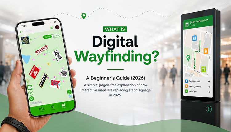
What Is Digital Wayfinding? A Beginner's Guide (2026)
A simple, jargon-free explanation of how interactive maps are replacing static signage in 2026
Ask ten people what "wayfinding" means, and most will describe a signboard pointing toward the restrooms. That's not wrong, exactly — it's just outdated. The signboard has a digital successor now, and it's changing how people move through airports, hospitals, campuses, and event grounds across India and beyond.
If you've landed here wondering what digital wayfinding actually means and whether it's relevant to your event, venue, or organisation, this guide walks through it in plain language — no jargon, no fluff.
Digital wayfinding is the use of interactive digital tools, apps, live maps, kiosks, or QR codes to help people navigate physical spaces like campuses, events, malls, or hospitals in real time. Unlike static signage, it updates instantly, works on a visitor's own phone, and can guide someone to an exact location step by step.
What Is Digital Wayfinding?
Digital wayfinding refers to any system that helps people find their way through a physical space using digital technology instead of fixed printed signs. Think interactive maps on a screen, a live map you open on your phone, or a QR code stuck to a wall that opens a navigable venue map the moment you scan it.
The core idea hasn't changed from traditional wayfinding — people still need to get from point A to point B without getting lost. What's changed is the delivery. A printed map is frozen the day it's printed. A digital wayfinding system can update the moment something changes: a stage moves, a gate closes, or a new stall opens.
This matters more than it sounds. Large venues — university campuses, hospitals, stadiums, and exhibition halls — are rarely static. Layouts shift for different events, temporary structures go up and come down, and visitor flow changes hour by hour. Digital wayfinding is built to handle that kind of movement.
How Digital Wayfinding Is Different From GPS Navigation
A common mix-up: digital wayfinding is not the same as Google Maps. GPS-based apps are built for roads and outdoor travel between cities or addresses. Digital wayfinding is built for the "last mile" — guiding someone once they've already arrived, often indoors or across a large campus where GPS signals are weak or the detail level is far too low to be useful.
How Does Digital Wayfinding Work?
At a basic level, a digital wayfinding system has three parts:
- A digital map of the venue — created once, then updated as needed, showing rooms, gates, stalls, restrooms, exits, or points of interest.
- An access point for visitors — this could be a mobile app, a web link, a QR code, or a physical kiosk screen.
- Real-time logic — the system calculates the best route, shows current status (open/closed, busy/free), and can push live updates.
For events specifically, most modern platforms let an organiser build the map in a browser, drop pins for stages, stalls, or facilities, add labels and branding, and then share it as a link or QR code that attendees scan on arrival. No app download needed, no printing required.
Types of Digital Wayfinding
Digital wayfinding isn't one single technology. It usually falls into a few categories:
- Indoor wayfinding — used inside malls, hospitals, airports, and office buildings where GPS is unreliable
- Outdoor wayfinding — used across large open venues like campuses, festival grounds, or theme parks
- QR code wayfinding — visitors scan a code at entry points to instantly load a live map; no app installation needed
- Kiosk-based wayfinding — touchscreen directories placed at entrances or lobbies
- App-based wayfinding — a dedicated mobile app with saved maps, often used by universities or large recurring events
Most organisations today lean toward QR codes and web-based wayfinding because it removes the biggest friction point: nobody wants to download an app for a one-day event.
Digital Wayfinding vs. Traditional Signage
| Factor | Traditional Signage | Digital Wayfinding |
|---|---|---|
| Updates | Requires reprinting | Instant, real-time |
| Cost over time | Repeated printing costs | One-time setup, reusable |
| Personalisation | None | Can show live status, alerts |
| Accessibility | Fixed viewing angle/location | Works on any visitor's phone |
| Data/insights | None | Tracks views, popular routes |
| Setup speed | Days (design, print, install) | Hours |
Traditional signage still has a place — nobody's removing exit signs. But for anything requiring flexibility, cost efficiency, or live updates, digital wayfinding is quickly becoming the default.
Benefits of Digital Wayfinding
- Reduces visitor confusion and complaints — people find what they need without asking staff repeatedly
- Cuts printing and reprinting costs — no more reprinting maps every time a layout changes
- Improves the overall visitor experience — a smooth arrival experience shapes how people remember an event or venue
- Provides usage data — organisers can see which areas get the most traffic and plan better next time
- Scales easily — one digital map can be updated and reused across multiple events or expanded as a venue grows
- Supports accessibility — larger text, zoom, and voice-guided options are far easier to build into a digital map than a printed one
Key Features to Look For
If you're evaluating a digital wayfinding tool for your venue or event, look for:
- Easy map creation without needing design or coding skills
- QR code generation for instant access
- Real-time editing (move a stall, update it live)
- Custom branding (logo, colours, labels)
- Mobile-friendly, no-app-download access
- Multi-location or multi-event support
- Analytics on visitor engagement
Real-World Examples
- University campuses use digital wayfinding to help new students and visitors navigate sprawling grounds during orientation week, when foot traffic and confusion are highest.
- Hospitals use it to reduce the anxiety of finding departments, a genuinely stressful moment for patients and families, where a wrong turn adds unnecessary stress.
- Trade shows and exhibitions use it so attendees can locate specific exhibitor booths without wandering entire halls.
- Festivals and outdoor events use QR-based live maps at entry gates so attendees can immediately locate stages, food stalls, and restrooms without needing a printed handout.
Best Practices
- Keep the map visually simple; too many icons crowd the experience and defeat the purpose
- Test the QR code or link on multiple phone types before going live
- Update the map the moment anything physically changes on-site
- Place QR codes at every entry point, not just the main gate
- Add a short instruction line ("Scan to view live map") so people know what the code does
Common Mistakes to Avoid
- Launching the map without testing it on slow mobile networks (common at large, crowded venues)
- Overloading the map with unnecessary detail instead of the essentials
- Forgetting to update the map after last-minute layout changes
- Not training on-ground staff to point visitors to the QR code
- Treating it as "set and forget" instead of reviewing usage data after the event
Expert Tips
After looking at how different venues implement this, a few things consistently separate the systems that work well from the ones that don't:
- The best digital wayfinding setups are built at least a few days before the event, not the night before — this gives time to test on real devices
- Simplicity beats completeness; a map with 10 clear points of interest works better than one with 50 cluttered pins
- Pairing a digital map with a handful of physical directional signs at key junctions still helps — digital and physical aren't mutually exclusive
Conclusion
Digital wayfinding isn't a futuristic concept anymore — it's a practical, cost-effective answer to a problem every event organiser, campus administrator, and facility manager already knows well: people get lost, and lost visitors are frustrated visitors. Whether it's a QR code at a festival gate or a live map for a hospital wing, digital wayfinding solves the same core problem traditional signage always tried to — just faster, cheaper, and with far more flexibility.
FAQs
1. What is digital wayfinding in simple terms?
It's using digital tools like apps, QR codes, or live maps — instead of printed signs — to help people navigate a physical space.
2. Is digital wayfinding the same as GPS navigation?
No. GPS apps are built for travel between locations on roads; digital wayfinding is built for navigating within a venue, often indoors or across large campuses where GPS isn't precise enough.
3. Do visitors need to download an app for digital wayfinding?
Not necessarily. Many modern systems work through a QR code or web link that opens directly in a phone's browser — no app install needed.
4. How much does digital wayfinding cost?
It varies by provider and venue size, but most web-based platforms are far cheaper long-term than repeated signage printing, since the map can be reused and edited.
5. Which industries use digital wayfinding the most?
Events, universities, hospitals, malls, airports, museums, and exhibition centres are the biggest adopters.
6. Can digital wayfinding maps be updated in real time?
Yes — that's one of its biggest advantages over printed maps. Changes like closed gates or moved stalls can be updated instantly.
7. Is digital wayfinding accessible for people with disabilities?
Well-designed systems can support zoom, larger text, and voice guidance, making them more adaptable than fixed printed signage.
8. How do I add digital wayfinding to my next event?
Choose a platform that lets you build a map without coding, add your branding, generate a QR code, and share it at entry points before the event begins.
9. What's the difference between indoor and outdoor digital wayfinding?
Indoor wayfinding is designed for enclosed spaces with a weak GPS signal (malls, hospitals), while outdoor wayfinding covers large open areas like campuses or festival grounds.
