Digital Wayfinding Apps: The Future of Visitor Navigation
Discover how digital wayfinding apps are transforming visitor navigation through interactive maps, QR code access, real-time updates, and mobile-first experiences.
Introduction
Finding your way around expansive physical spaces has historically been a significant challenge. Whether someone is arriving at a massive university campus, attending an international industry conference, exploring a sprawling multi-tiered sports complex, navigating a high-stakes hospital wing, or enjoying a vast public park, visitors routinely spend valuable time stressed out and searching for destinations instead of actually enjoying their experience.
For decades, organizations naturally relied on printed physical maps, hanging metal signs, and static downloadable PDF layouts to help people find their bearings. While these traditional analog methods served their original purpose, they frequently trigger modern visitor frustration, human bottlenecks, and massive operational inefficiencies.
Today, digital wayfinding apps are fundamentally changing how humanity navigates physical infrastructure.
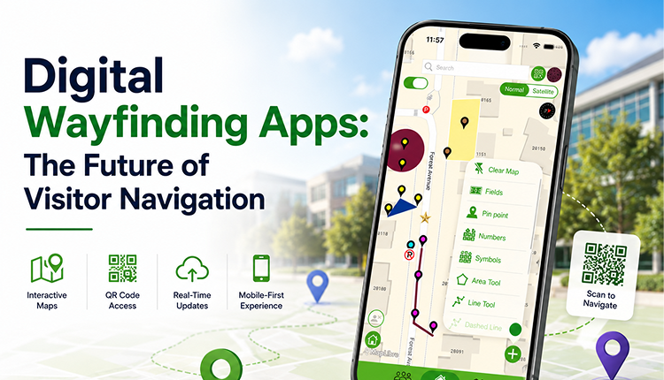
Powered by highly responsive interactive maps, friction-free QR code access points, instant real-time cloud updates, and mobile-first responsive coding, digital wayfinding applications make physical traversal smarter, faster, and more accessible than ever before. As consumer and visitor expectations continue to skyrocket, digital wayfinding has officially solidified itself as the undeniable future of physical navigation.
What Is a Digital Wayfinding App?
A digital wayfinding app is a modern, cloud-hosted navigation architecture designed to help users instantly locate points of interest and map out routes within a specific venue, campus, stadium, or macro facility using interactive digital graphics.
Unlike flat, legacy map diagrams, digital wayfinding apps allow users to:
-
Execute granular search queries for exact rooms, spaces, or vendors
-
View optimized, dynamic walking or transit routes
-
Access highly descriptive, embedded localized information pop-ups
-
Actively explore surrounding points of interest on a digital canvas
-
Navigate fluidly through personal smartphones, tablets, or kiosks
-
Receive instant, time-sensitive logistical updates in real time
These advanced capabilities allow visitors to break away from anxiety and move with total confidence through completely unfamiliar real-world environments.
Why Traditional Navigation Methods Are No Longer Enough
In a digital-first era, today's visitors expect instant access to precise information. Legacy navigation tools have entirely reached their operational limits:
Printed Maps Become Outdated Instantly
Physical venue layouts, vendor booth assignments, operational hours, and event schedules shift constantly. Printed paper cannot adapt, leading to immediate print waste and inaccurate crowd distribution.
Static PDF Maps Offer Zero Functionality
PDFs are rigid image blocks. Mobile users are forced into cumbersome pinch-to-zoom scrolling, and they cannot completely type into a search bar or receive live spatial alerts.
Physical Signage Can Be Confusing
Static directional signs are easily missed in dense crowds, become obscured at night, or are misinterpreted by international visitors unfamiliar with local structural terminology.
Venues are Scaling in complexity.
Modern university campuses, corporate centers, convention halls, and recreational parks continue to expand dramatically in scale. As infrastructure grows, the human brain requires an agile, digital guide to process the environment efficiently.
How Digital Wayfinding Apps Work
The user journey is engineered to be completely simple, lightweight, and frictionless:
[Step 1: Scan QR Code] ➔ [Step 2: Search Destination] ➔ [Step 3: Follow Dynamic Route] ➔ [Step 4: Receive Live Updates]
-
Access the Map: The visitor instantly launches the venue map interface by scanning an on-site physical QR code, clicking an embedded link on a website, opening a mobile app, or interacting with an on-site electronic kiosk.
-
Search a Destination: The user types their exact target into an intuitive search bar—such as a specific lecture hall classroom, an outdoor music festival stage, a stadium parking tier, a public restroom, or an exhibition vendor booth.
-
Follow Directions: The interactive map instantly updates, displaying a clear visual walking pathway from their starting point or orientation node directly to the destination.
-
Receive Updates: If a room changes or an emergency path closure occurs during the day, the change renders live on the screen without the user having to refresh their browser.
Key Features of Modern Digital Wayfinding Apps
To provide genuine utility to the public, an enterprise digital wayfinding system must prioritize these seven crucial features:
-
Fluid Interactive Maps: Seamlessly handles multi-touch gestures, allowing users to effortlessly pan, rotate, and zoom across complex coordinates.
-
Friction-Free QR Code Navigation: Instantly renders the full interactive layout within a native mobile browser via a simple camera scancompletely bypassing the friction of an app store download.
-
Real-Time Cloud Synchronization: Empower administrators to push graphical adjustments, safety alerts, or textual shifts across all live devices in mere seconds.
-
Mobile-First Responsive Layouts: Optimized for lightning-fast load times on cellular data networks and designed for single-handed mobile navigation while walking.
-
Smart Search Indices: Features autocomplete and keyword tag search capabilities, mapping out names, numbers, acronyms, and categories instantly.
-
Inclusive Accessibility Support: Features dedicated layout toggles that highlight step-free pathways, operational elevator positions, wheel-chair friendly building ramps, and designated ADA parking zones.
-
Granular Footprint Analytics: Captures completely anonymous, privacy-compliant aggregated visitor data, pinpointing hot traffic zones, popular destination clicks, and frequent search terms.
Tangible Advantages for Both Sides
For the Visitor
-
Stress-Free Experiences: Eliminates the mental fatigue and friction of getting lost in high-density areas.
-
Rapid Wayfinding: Empowers individuals to calculate the fastest path to their destination, ensuring they never miss classes, flights, or keynotes.
-
Always Accurate Data: Guarantees that the schedule, room description, and facility status they are looking at are correct at that exact hour.
For the Organization
-
Drastically Lower Material Overhead: Wipes out the recurring seasonal costs of designing, printing, distributing, and recycling thousands of physical paper maps.
-
Streamlined Support Staff: Front-line customer service counters and on-site security guards experience a massive drop in routine direction-pointing requests, letting them focus on true operational tasks.
-
Enhanced Spatial Control: Gives organizers the digital power to gently steer crowd movement away from congested choke points by updating recommended routes on the fly.
Digital Wayfinding Apps vs. Traditional Maps
| Feature | Modern Wayfinding Applications | Legacy PDF Files | Printed Paper Guides |
|---|---|---|---|
| Real-Time Updates | Yes, instant cloud push | No, requires complete re-upload | No, permanently unchangeable |
| Search Functionality | Yes, predictive keyword lookup | No, manual eye scanning only | No, must read page indexes |
| App-Free Mobile Access | Excellent, instant web rendering | Poor, clunky manual resizing | None, entirely physical medium |
| QR Code Deployment | Yes, launches instantly in browser | Limited, downloads a heavy file | No, offline analog format |
| Accessibility Routing | Advanced, dedicated step-free filters | Basic, limited icon markings | Basic, tiny print symbol markers |
| Backend Analytics Tracking | Yes, captures crowd interest trends | No, zero user insights visibility | No, completely unmeasurable |
Emerging Trends Shaping the Future of Navigation
As we navigate through 2026, the technology backing digital wayfinding continues to scale rapidly:
-
Precision Indoor Positioning (IPS): Integrating map software with Bluetooth Low Energy (BLE) hardware beacons to provide hyper-accurate "blue-dot" turn-by-turn routing inside complex, multi-level structures where GPS signals fail.
-
Augmented Reality (AR) Overlays: Giving users the ability to look through their phone's live camera view and see glowing, digital directional lines layered directly over the real-world sidewalks and hallways.
-
AI-Powered Behavioral Recommendations: Intelligent map modules that study aggregated spatial trends and gently recommend nearby food trucks, interesting vendor booths, or optimal rest zones tailored to the user's current track.
-
Live Crowd Congestion Management: Predictive algorithms that actively recalculate pathways for visitors to completely bypass heavily jammed corridors or long entrance lines.
How emapX Live Powers Digital Wayfinding
Moving completely away from rigid, legacy map design requires an agile technical partner. Specialized platforms like emapX - Live Custom Maps provide organizations across the globe with a robust, enterprise-grade toolkit to deploy custom interactive maps that entirely eliminate navigation friction.
By beautifully marrying interactive digital graphics, frictionless QR code scanning, instant cloud updating, custom white-label corporate branding, and direct website embedding, emapX Live enables facilities to confidently digitize their physical footprint. It bridges the gap between physical real estate and modern mobile convenience, delivering an elite spatial layer that today’s digital-native public relies on.
Frequently Asked Questions
What exactly is a digital wayfinding app?
A digital wayfinding app is a mobile-responsive, cloud-based platform that uses highly interactive graphics and search directories to help visitors easily navigate complex indoor and outdoor real-world environments.
Why is app-free QR code access better than an app store download?
App-free access entirely eliminates user friction. Visitors do not want to waste mobile data, check app store passwords, or wait to download a heavy application just to look at a map. A quick scan of a QR code opens the map inside their browser instantly.
Can digital wayfinding apps function seamlessly for indoor spaces?
Yes. Modern platforms map multi-level building floor plans seamlessly, allowing users to toggle between distinct floors, search specific room numbers, and locate elevators or stairs.
Is visitor tracking a privacy concern on these platforms?
No, tracking is completely secure and anonymous. Enterprise wayfinding platforms do not collect personal identities or private user data; they only capture aggregated trends—like total search keywords or total location pin clicks—to help managers optimize venue layouts.
Can an interactive map save my organization money?
Absolutely. By completely digitizing your venue layout, you eliminate the massive recurring costs of layout graphic redesigns, physical paper print production, and sign printing overhead.
Conclusion
The future of physical navigation is indisputably digital. As modern organizations continue to construct, operate, and manage increasingly intricate and sprawling physical environments, relying on outdated paper guides and static PDFs has become a massive liability to customer satisfaction.
Digital wayfinding applications successfully bridge this gap, equipping venues with the modern toolset required to guide visitors seamlessly, alleviate logistical stress, ensure true accessibility equity, and unlock incredibly valuable crowd data insights. By bringing together interactive spatial layouts, app-free QR code deployment, and live cloud management, these platforms offer a vastly superior, highly scalable alternative to legacy mediums.
For forward-thinking institutions aiming to completely elevate their spatial experience in 2026 and beyond, investing in a premier mapping infrastructure solution like emapX Live is no longer a luxury—it is the single most effective way to help the world connect confidently with the spaces around them.
What type of venue layout is your organization currently managing, and what is the biggest navigation hurdle your visitors face during peak hours?